Keneilwe Hlahane
University of Cape Town
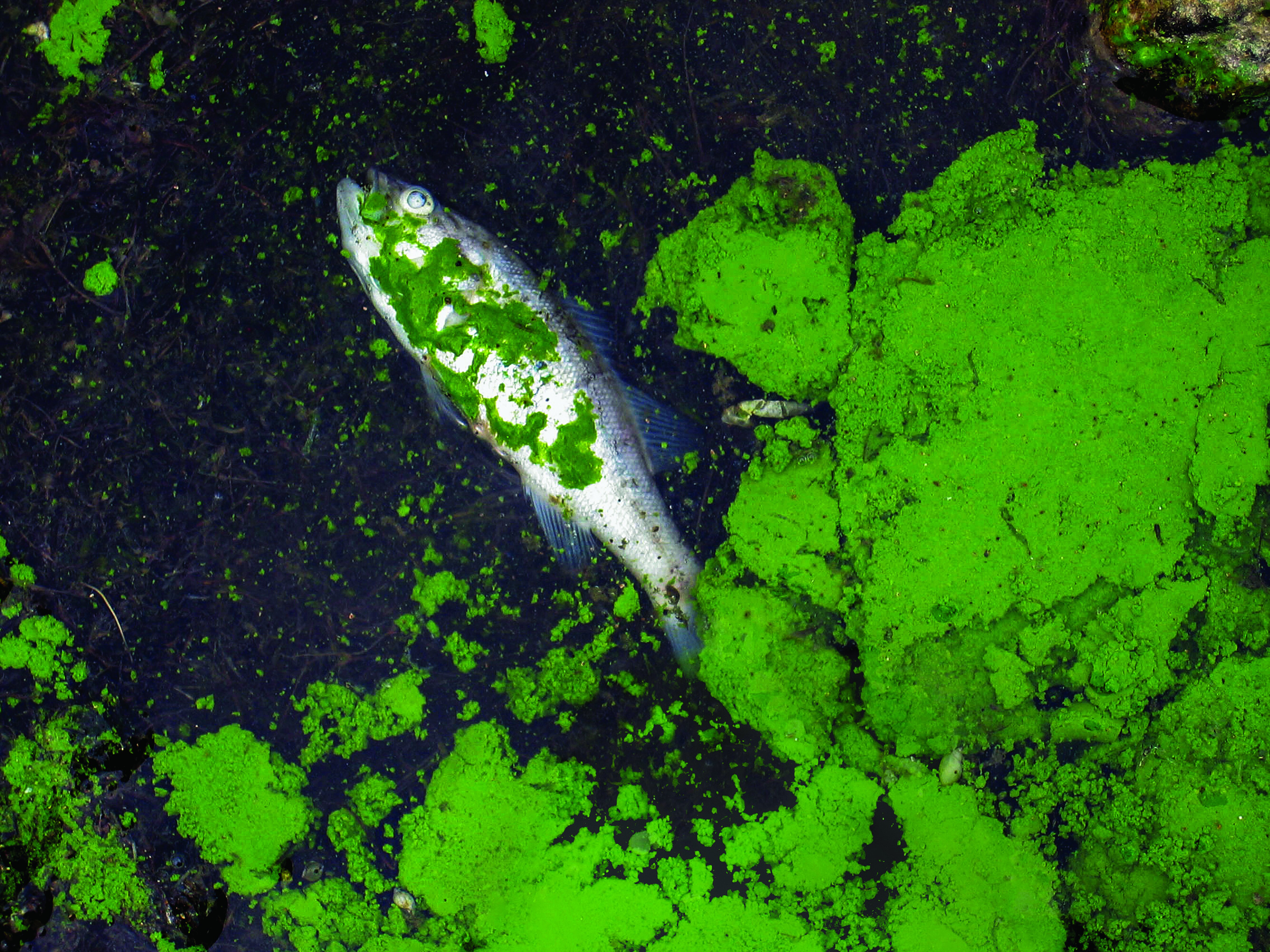
The water is green, a clear sign that it is polluted. Dense mats of algal blooms float on the surface of the dam, turning the water a dark green. Dead fish lie on the banks, their carcasses rotting in the hot sun. This is the state of many South African dams, as a result of eutrophication.
Eutrophication is a water pollution problem, caused by high levels of nitrogen and phosphorus nutrients in the dam, lake or river. It is a natural process, but pollution exacerbates it and makes it a serious – sometimes life threatening – problem. Agricultural fertilizers and raw sewage, which have high nutrient concentrations, run into the water bodies.
Just as “too much of a good thing is bad for you”, so too much nitrogen and phosphorus is bad for water systems. Certain plants and algae feed off the nutrients. They begin to spread and outcompete other species in the dam. Sunlight and oxygen become a valuable commodity as the nutrient-consuming plants begin to crowd out others. When these conquered plants die, the decomposing bacteria uses up more oxygen and affects other forms of aquatic life, such as fish. Over time, this eutrophication process reduces the water quality, causes growth of toxic algal blooms and destroys biodiversity.
South Africa is a water scarce country with low rainfall and frequent droughts. Most of the water we use comes from fresh water resources such as rivers, dams and lakes. But despite having these very real water difficulties, many of our freshwater resources face eutrophication.
This has serious implications for the economy, the environment and human health. Some of the algae in water systems with eutrophication produce toxins which directly affect humans and animal health. People will also be more prone to water-borne diseases such as cholera, and this problem disproportionately affects the poor because they struggle to access primary healthcare.
This means that the water has to be cleaned before consumption. This is expensive. It also results in negative environmental impacts such as loss of biodiversity, and fish and animal fatalities. In order to avoid this, we need to vigilantly monitor our water.
But monitoring the water quality in dams is a challenge. Traditionally, researchers collect water samples from rivers or dams, which are then taken to the laboratory for analysis. The reality is that collecting water samples is costly, labour intensive and cannot be done on a frequent basis. Traditional methods are also only able to tell you about the water quality at the point, and cannot tell you what is happening in the whole dam.
This is where satellite remote sensing technology can play a role. Advances in satellite remote sensing research have made it possible to track dam water quality from space. Just as your eyes help you distinguish the colour of water from blue, green and brown, so can satellites. Scientists measure different water quality variables using image pixels captured from satellites. Using satellites, we can monitor our water frequently, as satellites can capture images every two to three days. By tracking the differences in images over time, we can record seasonal and yearly changes. This technology also provides a widespread view of the water body, making it possible to gather information about inaccessible areas where it is not possible to gather information through ground surveys.
My research at the University of Cape Town focuses on using satellite remote sensing to monitor water quality at the Vaal Dam. This particular dam supplies water to South Africa’s main economic hub, Gauteng. People and mining industries located in this region rely on the Vaal Dam as their main source of water. However, the dam has high levels eutrophication which reduces its water quality.. Water with degraded quality is not safe for people, plants and animals to use, which is what happens when people obtain water directly from the dam.
Remote sensing satellites capture images of the Vaal dam each time they pass over it. We analyse the satellite image using Geographic Information Systems (GIS) and remote sensing software tools. We use specific water quality markers, namely chlorophyll-a, which points to the concentration of algae in the dam, and cyanobacteria, which give the water its green shine. These water quality parameters can tell us the level of eutrophication in the dam.
We then create maps from the data. Presenting the information in map-form makes it easier to visualise how the state of eutrophication is changing over time. Senior managers and policy makers can use these maps, to make informed decisions regarding the water challenges of Vaal Dam.
The extent of the eutrophication problem, with its toxic algal blooms, indicates the need for constant monitoring, in addition to the traditional sample-collection method. Satellite remote sensing offers a solution to better monitor our fresh water resources. However, there are still many limitations when monitoring water quality from satellite, and we need more research to make remote sensing as accurate as possible. In the long run, using satellites to monitor the country’s water could save lives and money.

Great article ~ si informative
Thank you, hope you have learned more about satellite remote sensing now
Nice work.
Just two questions, How accessible are the satellite imagery and where are you sourcing them for your research?
Thank you for reading. There are various satellite missions which have been launched for earth observation. Free satellite imagery can be accessed and downloaded from various space agencies websites, such as the European space agency,South African Space Agency, landsat website etc, depending on the type of satellite data you require.
For my study I am using MERIS satellite images which I obtained from the European Space Agengy website.
Very informative and thanks for the awareness. Great article indeed!!
Thank you. Hope you learned how satellite data can solve our problems